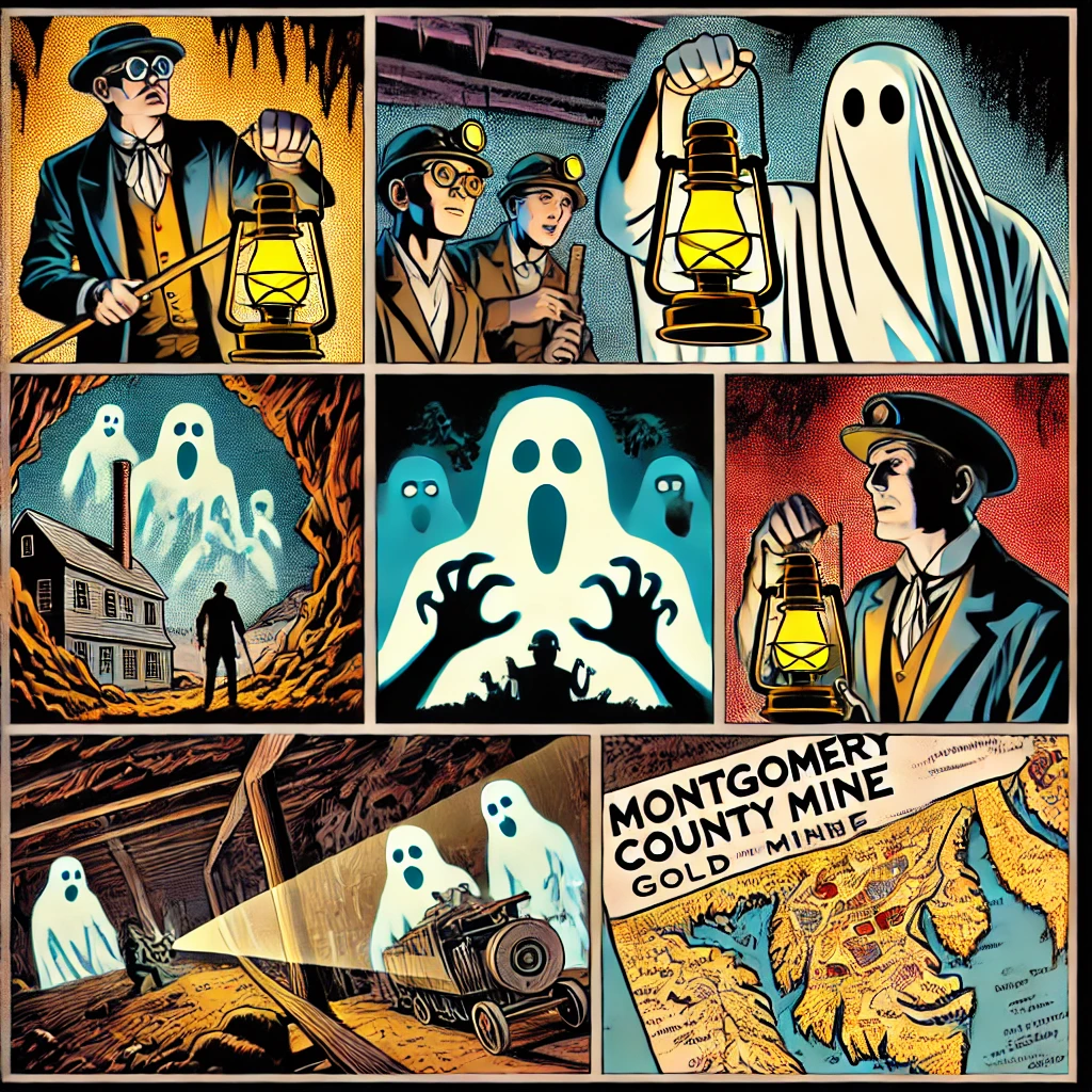
Tommyknockers of Maryland Gold Mines
A type of spirit linked to mining, Potomac’s tommyknocker sprang from a deadly explosion in 1906 at the now-abandoned Maryland gold mine located near the entrance of the C&O Canal’s Great Falls Tavern Visitor Center.
Early last century, Montgomery county, Maryland had over 28 gold mines. Wander the woods off MacArthur Boulevard at night, and legend has it you’ll see the fiery eyes of the tommyknocker burning into your soul. A type of spirit linked to mining, Potomac’s tommyknocker sprang from a deadly explosion in 1906 at the now-abandoned Maryland gold mine located near the entrance of the C&O Canal’s Great Falls Tavern Visitor Center.
The article “Tommyknockers and Maryland Gold Mines” explores the intersection of local folklore and the history of gold mining in Maryland, particularly focusing on the Maryland Mine near the C&O Canal’s Great Falls Tavern Visitor Center. According to the article, the legend of the tommyknocker in this area originated from a deadly explosion in 1906 at the now-abandoned Maryland Mine. Tommyknockers are mythical spirits associated with mining, often believed to be the souls of deceased miners who perished in accidents. They are said to inhabit mines, where their knocking sounds serve as ominous warnings of impending cave-ins. (Appalachian History)
The article also delves into the history of gold mining in Montgomery County, noting that the Maryland Mine began operations in 1867 after gold was discovered in the area by Union soldier William Clear in 1861. Mining activities continued intermittently until 1939, with a brief resurgence in 1934 when the price of gold increased to $35 per ounce. Today, the remnants of these mining operations can be explored via trails near the Great Falls Tavern, though visitors are advised to exercise caution due to the presence of old mine shafts.
The article provides a comprehensive overview of how local legends like the tommyknocker are intertwined with the historical context of gold mining in Maryland, offering insights into both the cultural and industrial heritage of the region.

Unveiling Maryland’s Gold Rush: Tommyknockers and Lost Mines
Deep in the heart of Maryland’s Montgomery County lies a forgotten world of gold mines and ghostly legends, where history and folklore intertwine. The story of the Maryland Mine, nestled near the C&O Canal’s Great Falls Tavern Visitor Center, is a captivating blend of historical intrigue and supernatural whispers.
The Maryland Gold Rush
It all began in 1861, during the tumultuous days of the American Civil War. Union soldier William Clear stumbled upon gold in the region, sparking a small-scale gold rush that would culminate in the establishment of the Maryland Mine in 1867. For decades, miners labored tirelessly, extracting gold and contributing to the region’s burgeoning economy.
Despite its promise, the mine’s operations were intermittent. Economic challenges and fluctuating gold prices made it difficult for the industry to thrive. However, a brief resurgence occurred in 1934 when the price of gold rose to $35 per ounce, rekindling hopes of prosperity. By 1939, the Maryland Mine was abandoned, leaving behind remnants of its golden dreams. Today, hikers exploring the trails near the Great Falls Tavern can catch glimpses of the mine’s past, though caution is advised due to hidden shafts and crumbling structures.
The Tommyknocker Legends
Adding an eerie layer to this history is the legend of the tommyknockers—mythical spirits said to inhabit mines. These spirits, believed to be the souls of miners who perished in tragic accidents, were both feared and revered by those who worked underground. According to folklore, the knocking sounds of the tommyknockers served as warnings of impending cave-ins, offering miners a slim chance to escape disaster.
In the case of the Maryland Mine, the tommyknocker legend gained traction after a deadly explosion rocked the site in 1906. The blast claimed several lives, and local lore suggests that the spirits of these lost miners still linger in the abandoned shafts, their ghostly knocks echoing through the darkness.
Exploring Maryland’s Gold Mining Legacy
Today, the stories of the Maryland Mine and its tommyknockers offer a fascinating window into the region’s past. The gold rush may have faded, but the cultural and industrial heritage it left behind continues to capture the imagination. Visitors to the area can walk the trails near the Great Falls Tavern, marveling at the remnants of a bygone era while contemplating the mysteries of the tommyknockers.
Whether you’re a history buff, a folklore enthusiast, or simply an adventurer seeking the hidden treasures of Maryland, the story of the Maryland Mine is sure to leave an indelible impression. The echoes of gold-seekers and ghostly miners alike remind us of the enduring power of human ambition and imagination.
The Search for Gold – Exploring the past in the Gold Mine Tract along the C & O Canal by Ed Talone, Potomac Trace, Aug 2005
Most Americans have heard of the famous gold strikes in California and Alaska. Hikers on the C&O Canal, a segment of the PHT [Potomac History Trace?], might be surprised to know that two gold mining operations took place practically within sight of the towpath. Two mine sites are located near the Great Falls Tavern, 14.5 miles above Georgetown.
According to Walter Goetz, in his 1988 book Montgomery County Gold Fever, the discovery of gold at Great Falls is credited to a Union soldier named William Clear. In 1861, he was camped there while on duty with a Pennsylcania regiment. The story goes that while tending a cmapfire he noticed a rock which reminded him of those from his native California. Breaking it open he spotted gold. The war intervened, but in 1865 Clear returned to purchase land in the area. At the same time two fellow soldiers invested in an adjoining property to create the Maryland Mine.
Ore was brought to the surface in 1866 and the first shafts were dug in 1867. Testimony to the interest in gold mining here can be seen in the number of different investors attracted, including the Dumonts of Delaware.
Between 1915 and 1917 extensive digging drew the attention of locals who feared trenches were being dug for a German invasion. An official from the US Geological Survey traveled to the site to verify mining activity and allay concerns. Mining continuted here until 1939.
The second mine at Great Falls, Ford Mine, opened in 1889 about a mile west of Great Falls Tavern. By 1917 there were three work sites, two stamp mills to break up ore, an assay laboratory, hoisting machinery, coal sheds and head frames. One site was so rich in ore it earned the nickname “Glory Hole.”
Goetz tells us mining here waned in the early 1920s. Because the US currency was backed by gold, the US Mint set the price and had purchase rights to all gold — in fact it was illegal to sell to anyone else. The Mint fixed the price at $20.67 per ounce, too low to make a profit from the Great Falls veins.
Mine operators found ways around this, as evidenced by the curious record of gold output at Ford Mine. In all its years of operation, not one ounce of hold was recorded at the US Mint as having come from this mine. Speculation is that some of this mine’s output showed up in the shop windows of local jewelers who never seemed to run short.
The final boom time for the Great Falls mines came in 1934 when a law was passed raising the price of gold to $35 an ounce. This made mining profitable again and the mine ran until 1940. That year a group from Canada was looking to keep things going but ran into government regulations forbidding foreign investment in the mine. This marked the final cahpter in mining at Great Falls.
Hiking the Hold Mines
Trails lead to both mine sites from near the Tavern. The blue-blazed Ford Minue Trail leaves from the west end of the upper parking lot. It takes a keen eye to find the ruins here. The Maryland Mine is located about a hald mile up a blue-blazed trail that begins next to the Tavern. Trenches can be noted along the trail at right angles to the canal. They features rounded edges and mounds on top from soil. The mine site itself is fenced off because of the many shafts in the area.
Make no mistake though … at night all old mines come alive. Brave-hearted hikers might still hear ore cars rumbling underground and the movements of restless “tommyknockers.” These ghosts of men killed in the mines, legend says, continue to search for the gold they know is waiting to be found.www.nps.gov/grfa
GOOGLE MAP
https://www.google.com/maps/place/38°58’51.7″N+77°13’27.9″W/@38.981038,-77.2270042,872m
A Hike That’s Pure Gold by Jeff Bagato
Special to The Washington Post
Reprinted from The Washington Post 11/23/01
On the trail to the Maryland Mine above Great Falls and the C&O Canal, the freshly fallen leaves rattle underfoot so loudly I can barely hear my guide, Ranger Rod Sauter, pointing out the signs of excavation hidden in the terrain. The Gold Mine Loop leads up the hill above the Great Falls Tavern through thick woods of majestic tulip trees, young American beech and skinny papaws. Although mining stopped long ago- the work simply was not profitable enough to continue- visitors to the park can experience gold fever just by viewing the mill ruins and other mining features in C&O Canal National Historical Park.
“This is one of the main Maryland mining sites, and one of the most easily observed and accessible mining sites in the park,” notes Sauter, supervisory ranger for the park’s Great Falls Interpretive District.
Legend has it that a Union soldier camping near Great Falls, Md., was washing dishes when he saw gold flecks sparkling in the stream. His discovery jump-started a miniature East Coast gold rush that resulted in 30 small mines spread across the hills of Montgomery County above the falls. The remains of two other mines, the Ford and the Anderson, are within park boundaries. This activity rekindled an industry that in Maryland is as old as 1829, according to Walter Goetz’s booklet “Montgomery County Gold Fever” (available in the Tavern gift shop, which also houses a small exhibit on Great Falls mining).
The first of the new mines, the Maryland Mine, was founded by former Union soldiers in 1865 who incorporated as the Maryland Mining Co. The next year, the Maryland Mine began to produce actual gold, and the Union Arch Mine was founded in the surrounding area, near what is now the Cabin John Bridge. Over the following decades, mining occurred sporadically on the Maryland Mine site, as various companies gave up and were reinfected with gold fever. The hike follows the path of this history as it moves uphill from the Tavern just over a mile the mine ruins, and the round trip takes about two hours. Less ambitious gold enthusiasts may take a five-minute shortcut down the Falls Road Spur, near the intersection of MacArthur Boulevard and Falls Road.
Off the trail and up a hill, we spot one of the first landmarks, a long ridge of earth- now covered over in leaves- that clearly isn’t nature’s landscaping. A closer look reveals a two-foot-deep prospecting trench dug from east to west to locate the vein of quartz running north-south, represented on the current topography by a perpendicular groove. During World War I, the Atlantic Development Co. spent $130,000 on this excavation. (The mysterious work back in the woods caused locals to suspect that a German invasion force was digging trenches in the hills, and federal authorities were called in to investigate.) Today, small chunks of quartz poke up from the leaf cover; these chunks are the remains of mining activity. Some larger pieces farther down the hill may have naturally broken through the soil with erosion, Sauter says; these quartz boulders, or “floats,” would have signaled the nearby vein.
Farther up the hill, we come to our first mine shaft, originally dug in 1867. The shaft was filled in years ago for safety reasons; these days, it’s just a giant indentation lined with leaves, and a mature tree grown from the center of the bowl. Nearby and enclosed in tall chain link fence lies a jumbled pile of rusted corrugated sheet metal. After a moment’s study, it’s not hard to see that it once was a rather large structure, albeit one that collapsed almost half a century ago. This ruin was a crushing mill, built in 1935 by yet another Maryland Mining Co. when gold prices rose to $35 per ounce. Here, quartz rock was broken into successively smaller chunks in preparation for amalgamation, in which the crushed quartz sand was washed over a copper plate coated in mercury. The mercury combined with the gold, forming an amalgam that stuck to the copper.
Near the mill lie the ruins of other company buildings; the assay office and water tower have been reconstructed, but are protected by tall fences and signage offering stern warnings of the dangers of hidden mine shafts and rickety construction. Underground and unseen lie three or four mine shafts up to 200 feet deep and horizontal tunnels, called adits in the trade, which were dug along the quartz veins. This last Maryland Mining Co. worked the area until 1940. There has been no mining activity on the site since then.
Sauter can’t help but compare all that effort and expense to the total gold recovery from all the Montgomery County mines from 1860 to 1951: a mere 5,000 ounces. At today’s price of $277.80 per troy ounce, that’s $1,389,000 worth, although historical payouts totaled only $150,000.
“Gold digging is literally a scheme to get rich quick,” Sauter says. “But if you look at the effort put in here, it definitely wasn’t a way to get rich quick. The challenge was to find where the gold was and how to get it out. It was just too expensive.” Over time, he adds, “the land itself became more valuable, especially being underdeveloped land in a highly developed area.”
Before I have a chance to ask, Sauter notes that mining and panning for gold are no longer allowed here: “The gold deposits are protected by the park.”
That fact, and the knowledge of poor financial returns, doesn’t discourage most people , however. “I tell people about all the effort involved in prospecting,” Sauter says, “but when I ask them if they would still do it, they say ‘Yeah!’”
For more information and a schedule of future “Get Rich Quick?” hikes, please call the Great Falls Tavern Visitor Center at (301) 767-3714.http://www.nps.gov/choh/Recreation/Trails/Gold.html
Maryland Mine (Allen Shaft), Cropley, Montgomery Co., Maryland, USA
Ref.: Maryland Geological Survey, Vol. VIII (1909): 151; Rocks & Min.: 11:121; 14:301; 22:834. A gold mine owned by the Maryland Gold Mining Co. Started about 1867. Host rock is mica schist and gneiss. Workings featured a 210 foot (60 meter) deep shaft. Located about 1 mile East of Great Falls, near Bethesda and Silver Spring.
Map Reference: 38°59’N , 77°13’W
Important Disclaimer: This locality information is for reference purposes only. You should never attempt to visit any sites listed in mindat.org without first ensuring that you have the permission of the land and/or mineral rights holders for access and that you are aware of all safety precautions necessary.
https://www.mgs.md.gov/esic/brochures/edugold.html
Montgomery County was known for gold mining in the 19th Century
Gold was discovered on Samuel Ellicott’s farm in 1849 near Brookeville. During the Civil War, privates named Cleary and McClaren from the 71st Pennsylvania Regiment were washing their dishes in the Rock Run Stream near Great Falls (Potomac River) when they saw glistening gold flakes in the water.
Area peeps quickly caught fever. A 100-foot shaft was dug near the intersection of MacArthur Boulevard and Falls Road around 1867. This mine became the largest and most successful mine in the county. It operated under several different names over 73 years.
In an area above the Great Falls Tavern people found gold in the 1880s in Ford Mine. The Great Falls Mining Company found a vein of gold east of the current parking lot entrance to Great Falls Park.
Over 200-foot shafts with interconnecting tunnels were uncovered between 1900 and 1917. In 1918, the Atlantic Development Company used the most trenching equipment to search for gold. While they were digging, people in the town started rumors that the real purpose of the trenches was to prepare for a German attack on Washington.
Montgomery County had over 28 gold mines during this time.
The local gold mining died after World War I. The mines closed for a brief time in 1922, but during the Depression gold prices shot up to $35 per ounce and the mines reopened. Mining continued between the years of 1936 and 1940.
The suburban area started growing and houses were springing up all over. The land became more valuable than the gold so gold mining stopped.
A developer had a zoning problem in 1970 when he was trying to build 16 houses close to the Landon School. The area that he wanted to build was filled with tunnels and shafts that covered the entire area. He had the entrance to the mine opened, and he pumped water out of the tunnels to discover an ore car inside the mine. The mine was sealed back up and was allowed to fill again with the ore car still inside.
Many people put in time and energy searching for the gold in Rock Creek trying to unearth wealth; most were disappointed.

Waking the tommyknockers: Mine said to be haunted
By Monica P. Wraga // Gazette Staff Writer // Oct. 30, 2002
gazette article
Wander the woods off MacArthur Boulevard at night, and legend has it you’ll see the fiery eyes of the tommyknocker burning into your soul.
A type of spirit linked to mining, Potomac’s tommyknocker sprang from a deadly explosion in 1906 at the now-abandoned Maryland gold mine located near the entrance of the C&O Canal’s Great Falls Tavern Visitor Center.
Sightings of the ghostly man with fiery eyes crawling from the mine at night, dragging a long tail behind him, drove night watchmen and miners from the property in droves, said Kathleen Kelly, a National Park Service ranger who has researched the mine’s history.
“A ghostie-looking man with eyes of fire and a tail 10 feet long crawled out of the shaft and disappeared in the forest,” Kelly read from an historical account of the night watchman credited with telling foreman Edgar Ingalls about the first known sighting of the tommyknocker. “Mr. Ingalls, I ain’t doin’ that job no more.”
The mine closed in 1908, reopening briefly when the price of gold rose in 1913, 1915 and 1935, Kelly said. Today the abandoned property, pock-marked with sink holes, a decomposing water tower and buildings, lies behind a chain-link fence yards from the intersection of Falls Road and MacArthur Boulevard.
We didn’t find the tommyknocker when your reporter and photographer visited the site Friday with Beverly Litsinger of Randallstown, founder of the Maryland Ghost and Spirit Association.
But we did find a particularly friendly ghost named Charles.
Armed with two types of electromagnetic field (EMF) detectors, an infrared temperature scanner, notepads, cameras and a tape recorder, the three of us trekked to the property, owned by the National Park Service, in search of ghostly activity. Litsinger often leads such investigations, and has visited a variety of schools, cemeteries, battlefields and statues in Maryland that are said to be haunted.
After a brief hike through the woods, which is accessible by the C&O Canal’s Goldmine Loop trail at Great Falls, we reached the abandoned property. Signs behind the property’s chain-link fences caution, “Stay Out! Stay Alive!” and warn of collapsing mine shafts, dangerous fumes and remaining dynamite.
But Litsinger, who says she has been able to see and communicate with ghosts since childhood, was far more concerned with other aspects of the mine.
“It caved in and people died,” Litsinger said, approaching the chain-link fences that rim its perimeter. “So it’s probably got an energy there.”
According to survivors’ accounts, miners were preparing to set a blast in one of the mine’s 500-foot tunnels at 10:45 p.m. on June 15, 1906. Before lighting the dynamite, they gathered in the mine’s “hoist house” — a building covering the pulleys that lead into the mine — for a drink.
Miners put a box of dynamite on a bench while they sipped from a “Georgetown bottle,” liquor purchased in Georgetown during a trip down the C&O Canal. While drinking, one of the miners placed his helmet, with a lit candle mounted on top, next to the dynamite.
The dynamite’s fuse caught fire, sending miners scrambling from the building. The explosion collapsed the hoist house, killing miner Charles Eglin.
Strange occurrences began to happen immediately after Eglin’s death. First, a horse that worked at the mine refused to set one hoof through the property’s gates and would instead rear, snort and paw the air.
Then the suspicious noises started.
“Supposedly, people started hearing footsteps behind them and strange noises especially at night,” Kelly said. “The night watchmen said he could hear footsteps come up the gravel path right up the office door. There would be knocks on the door, but when he would open it, no one would be there.”
Soon after, the night watchman reported his first sighting of the tommyknocker. “I started to shoot, but I remembered the tommyknocker could throw the shot back in my face,” the night watchman told his foreman.
After the night watchman quit, it was impossible to fill his position, Kelly said. The cost of running the mine, coupled with the ominous legend of the tommyknocker, led to its permanent closure.
‘Hello, Charles’
At the site Friday, Litsinger produced two EMF detectors and began waving them in the air by the property’s fence. Immediately, the levels of one detector spiked from the normal “green” range of zero to three to a “red” range of between eight and 10.
“Yes, here,” Litsinger said, smiling and gesturing toward a corner of the fence where a ghost lurked.
“We know you’re here,” Litsinger told the ghost. “I’ve been wanting to come here for some time. We’re here to visit and learn about this place because it’s a historical site.”
Litsinger switched to a digital EMF detector, which breaks readings down into decimal points.
“Are there any other ghosts with you?” she asked, grinning as the meter jumped from .02 to .10. “See? That’s a yes,” she added, turning to us.
Litsinger encouraged your reporter and photographer to ask questions of the ghost as well. Recalling the name of the miner who died in 1906 explosion, your reporter asked whether his name was Charles. The meter again jumped from .03 to above .10.
“Hello, Charles,” we said in unison.
Charles did not return the greeting.
Lunch with Charles
Ghosts may be linked to land where they died, a building, loved ones, or even a particular object, said Litsinger, who is writing a book about Maryland ghosts. She tracks hauntings statewide through the Maryland Ghost and Spirit Association, which she founded two years ago, posting them by county on the group’s Web site.
Litsinger said she learned at a young age that discussing the specters she routinely saw meant being labeled “crazy” by peers, family members and friends. Her daughter, Jennifer Litsinger, 30, who also sees ghosts, prompted her to overcome that fear and found the association.
In two years, the group has grown to include more than 800 members, Beverly Litsinger said. “I just thought it would be a little thing I did for my daughter, but it grew,” she said.
Spirits continue to visit their home, including Beverly Litsinger’s father, who died in 1985 but visits as a friendly poltergeist, rattling spoons and moving furniture to make her laugh, she said.
After death, souls often don’t realize that they are dead and remain close to where they lived or worked, Litsinger said. Others remain to look after loved ones or may feel guilt about a wrong committed during life, she said.
“One of the miners may think he caused the mining accident and may be here trying to fix things,” she said.
If possible, Litsinger tries to help the ghosts move on from their past lives. “You don’t have to stay here,” she told Charles on Friday. “You can move on and try to find your loved ones. I’m sure they’ve been looking for you.”
Wandering farther into the property, Litsinger and your photographer, who also carried an EMF detector, found two other ghosts near the crumbling foundation of what once was the mine’s office.
Your photographer primed her camera, but as she pushed the trigger to take a picture, the battery suddenly drained — a normal occurrence, Litsinger said.
“Always ask permission,” Litsinger cautioned. “[Ghosts] will mess up your batteries. I always treat them with respect, as I would any person.”
Cameras can often capture images of ghosts the human eye could not see, Litsinger said. Her scrapbooks are filled with pictures of orbs and ectoplasms, globule-like forms out of which the images of ghosts emerge, she said. Ghostly faces peer from the background of some of her pictures, while glowing orbs and foggy shadows fill the background on others.
None of your photographer’s shots showed any sign of the ghosts. But a quick EMF scan during lunch at Old Angler’s Inn — which, built in the 1860s, is old enough to have ghosts of its own, Litsinger said — showed your reporter may have picked up a paranormal souvenir of the day’s adventures.
“Looks like you’ve picked up a ghost,” said Litsinger, who added that ghosts often follow her home from her visits to cemeteries and other haunted locales. “You may remind him of someone he knew in a past life.”
Litsinger instructed your reporter to send the ghost away by firmly asking it to leave and explaining why its company is not desired. But, feeling sorry for the lonely ghost who could be named Charles, your reporter decided to let it stay for lunch.
Walter A. Goetz is a leading authority on gold mining in Maryland. Mr. Geotz writes:
I did extensive research, identified and corrected references that other authors had “copied”, and personally located and verified the “on site” remains of the gold mines. In reference to Maryland gold mines, I have a very large collection of books and memorabilia, photographs, vintage maps, reference documents, copies of vintage newspaper articles, and other references. I started this research 30 years ago and continue to update and expand my collection. I’m always interested in learning more and acquiring more documentation on Maryland gold mining history.
Mr. Goetz has written the following publications on gold mining in Maryland:
* Maryland Gold Fever (revised 1996, 50 pages, 8 1/2″x 11″, including foldout map of mines and locations, plus 5 pg. bibliography) $9.50 postage paid.
* Montgomery County Gold Fever (1988, 54 pages, 8 1/2″x 11″, foldout map, plus 5 pg. bibliography) $8.50 postage paid.
* Fairfax Gold Fever (1984, 35 pages, 8 1/2″x 11″,including bibliography, referring to Fairfax County, Virginia, on the same gold vein that crosses the Potomac River from Montgomery County, Maryland.) $6.50 postage paid.
* Gold Mining in Great Falls of Maryland (1975, 16″x22″ map) $1.25
These books are can be ordered (postpaid) directly from Mr. Goetz : Mr. Walter Goetz, 9107 Kirkdale Road, Bethesda, Maryland 20817, mgoetz@erols.com, 301-530-7462
The Gold Mine Loop Trails, from the Great Falls Tavern, Great Falls Park, Maryland // (blue-blazed) 4.2 miles Deer, fox, and woodpeckers share the gentle wooded trail with remains of mine diggings. The Maryland Mine (1867-1939) processed gold near Falls Rd. and MacArthur Blvd. Begin the blue blazed trail uphill behind the Tavern. spur trails (yellow) lead to mine ruins, to Angler’s Inn, and to Berma Road near Lock 16.

Old Line State Gold
The Maryland Journal reported in May, 1901 that “Many persons will be surprised to know that within easy walking distance of the National Capital there are no less than a half-dozen gold mines in actual operation. Prospecting is now a rather extensive industry along the banks of the Potomac, from a point near Georgetown up the river, past Great Falls, a distance of perhaps ten miles.” Although no mining is currently underway in Maryland, individuals still seek their fortunes in gold.
Although gold was first reported in 1849 on Samuel Ellicott’s farm near Brookville, Montgomery County (the bulk of today’s gold concentration in Maryland), no production was recorded. There are numerous versions of the first discovery of gold in the Potomac area. In 1861 during the Civil War, a Private McCleary (or McCarey) of the 71st Pennsylvania Regiment (or “1st California Volunteers”) was stationed outside of Washington, D.C. While encamped in the vicinity of Great Falls, he discovered gold. It is reported that the gold was found while washing skillets in a stream near McCleary’s hilltop camp overlooking the old Anglers Club. By 1867 the first shaft was sunk near the site of the Maryland Mine. Since then, gold production went into full force until the last mine was closed in 1951.
A “placer deposit” is a concentration of a natural material that has accumulated in unconsolidated sediments of a stream bed, beach, or residual deposit. Gold derived by weathering or other process from lode deposits is likely to accumulate in placer deposits because of its weight and resistance to corrosion. In addition, its characteristically sun-yellow color makes it easily and quickly recognizable even in very small quantities.
The gold pan or miner’s pan is a shallow sheet-iron vessel with sloping sides and flat bottom used to wash gold-bearing gravel or other material containing heavy minerals. The process of washing material in a pan, referred to as “panning,” is the simplest, most commonly used, and least expensive method for a prospector to separate gold from the silt, sand, and gravel of the stream deposits. It is a tedious, back-breaking job and only with practice does one become proficient in the operation. Thankfully, technology finally caught up with our gold fever and brought us metal detectors!
Unlike many other New England states, Maryland’s gold is not the result of glacial deposition. In fact, its in relation to the metamorphic gravels of the Piedmont Plateau, a belt of metamorphic rocks extending from New York to South Carolina. The metal occurs as grains, wires or sheets in quartz veins and along mineralized fault zones in the surrounding metamorphic rocks. The distribution of gold in the quartz veins is sporadic and the concentration ranges from 0.1 to 5 ppm (Reed and Reed, 1969). Sulfides sometimes found with the gold are pyrite, sphalerite, and galena. In the copper districts of Maryland, gold has often been noted as a minor accessory mineral.
While Montgomery County holds the record, gold has also been found in Carroll, Frederick, Howard, Baltimore, and Harford Counties. If you can find an old mine dump (tailing), you will probably have great success with a metal detector due to the primitiveness of early mining. As always, ask for permission before detecting / panning on private property.
* Check with the Maryland Forest and Parks service for info on detecting or panning on state owned lands.
* For federally owned property, check with the Superintendent of Parks
* Other helpful resources include the Maryland Dept of Resources and the Maryland Geological Survey


1 Ellicott mine
2 Maryland mine
3 Allerton-Ream property (Ford mine) and open cuts
4 Anderson property (Potomac and Watson mines)
5 Montgomery mine (near Alton), shaft and prospect pits
6 Eagle mine
7 Harrison mine (Sawyer) and property, eight veins prospected
8 Rock Run gold placers
9 Irma and Lynch mines
10 Bogley mine
11 Haddlestone mine
12 Bethesda mine
13 Miller mine, several abandoned shafts and prospect holes
14 Several unnamed prospects
15 Gold reported at Glen Echo
16 East fork of Cabin John Run
17 Rockville gold locale
18 Fawsett mine
19 Gillotts mine
20 Grady mine
21 Stevens-Roudebush mine
22 Allen shaft
24 Black Hills mine or prospect
25 Dawsonville placer
26 Olney, possible prospect pit
27 Tridelphia Reservoir, reported occurrence
28 Mt. Ephraim mine, approx. loc.
29 Minor gold found in Liberty copper mine
30 Minor gold found in Repp copper mine
31 Minor gold found in Pittinger (Hammond) copper prospect
32 Minor gold found in New London copper deposit
33 Clifton (Frederick) mine
34 Gold discovered along ridge running through Manchester to Cranberry Valley
35 Streaker Road mine
36 Minor gold found in Mineral Hill copper mine
37 Minor gold found in Sykesville copper mine
38 Costley mine
39 Windsor Mill mine
40 Gold found in quartz near Catonsville
41 Gold has been reported near Ellicott City
42 Reported gold mine near Prettyboy Reservoir
43 Hayes mine
44 Macon gold placer
45 Gold bearing quartz reported near Havre de Grace
–http://www.treasurefish.com/maryland%20metal%20detecting.htm
| Maryland Mine | |||
| Feature Name | County | Latitude | Longitude |
| Allender Road Pit | Baltimore | 39.39167 | -76.39194 |
| Bradshaw Pit | Baltimore | 39.40694 | -76.38139 |
| Campbell Quarry | Baltimore | 39.4625 | -76.64889 |
| Caves Ore Bank | Baltimore | 39.43472 | -76.7375 |
| Cross Ore Bank | Baltimore | 39.41667 | -76.72083 |
| Cumberland Quarry | Allegany | 39.65667 | -78.94306 |
| Dargan Quarry | Washington | 39.36944 | -77.74333 |
| Days Cove Pit | Baltimore | 39.39694 | -76.38944 |
| Gunpowder Quarry | Baltimore | 39.4225 | -76.50722 |
| Hydes Quarry | Carroll | 39.565 | -77.07306 |
| Le Gore Quarry | Frederick | 39.54861 | -77.31056 |
| Maryland Mine | Montgomery | 38.99556 | -77.23194 |
| McClenahan Granite Quarry | Cecil | 39.58556 | -76.09861 |
| Number 1 Mine | Garrett | 39.625 | -79.19028 |
| Oregon Ore Bank | Baltimore | 39.49222 | -76.68861 |
| Pinesburg Quarry | Washington | 39.61667 | -77.88 |
| Port Deposit Quarry | Cecil | 39.61722 | -76.12917 |
| Sausman Mine | Garrett | 39.71361 | -79.34694 |
| Schwartz Pit | Baltimore | 39.38139 | -76.43611 |
| Seneca Quarry | Montgomery | 39.0775 | -77.35417 |
| Smuck Pit | Baltimore | 39.39444 | -76.37639 |
| Wilson Quarry | Washington | 39.65472 | -77.85222 |
–http://www.brainygeography.com/types/MD.mine.html

A Hike That’s Pure Gold
By Jeff Bagato // Special to The Washington Post // 11/23/01
On the trail to the Maryland Mine above Great Falls and the C&O Canal, the freshly fallen leaves rattle underfoot so loudly I can barely hear my guide, Ranger Rod Sauter, pointing out the signs of excavation hidden in the terrain. The Gold Mine Loop leads up the hill above the Great Falls Tavern through thick woods of majestic tulip trees, young American beech and skinny papaws. Although mining stopped long ago- the work simply was not profitable enough to continue- visitors to the park can experience gold fever just by viewing the mill ruins and other mining features in C&O Canal National Historical Park.
“This is one of the main Maryland mining sites, and one of the most easily observed and accessible mining sites in the park,” notes Sauter, supervisory ranger for the park’s Great Falls Interpretive District.
Legend has it that a Union soldier camping near Great Falls, Md., was washing dishes when he saw gold flecks sparkling in the stream. His discovery jump-started a miniature East Coast gold rush that resulted in 30 small mines spread across the hills of Montgomery County above the falls. The remains of two other mines, the Ford and the Anderson, are within park boundaries. This activity rekindled an industry that in Maryland is as old as 1829, according to Walter Goetz’s booklet “Montgomery County Gold Fever” (available in the Tavern gift shop, which also houses a small exhibit on Great Falls mining).
The first of the new mines, the Maryland Mine, was founded by former Union soldiers in 1865 who incorporated as the Maryland Mining Co. The next year, the Maryland Mine began to produce actual gold, and the Union Arch Mine was founded in the surrounding area, near what is now the Cabin John Bridge. Over the following decades, mining occurred sporadically on the Maryland Mine site, as various companies gave up and were reinfected with gold fever. The hike follows the path of this history as it moves uphill from the Tavern just over a mile the mine ruins, and the round trip takes about two hours. Less ambitious gold enthusiasts may take a five-minute shortcut down the Falls Road Spur, near the intersection of MacArthur Boulevard and Falls Road.
Off the trail and up a hill, we spot one of the first landmarks, a long ridge of earth- now covered over in leaves- that clearly isn’t nature’s landscaping. A closer look reveals a two-foot-deep prospecting trench dug from east to west to locate the vein of quartz running north-south, represented on the current topography by a perpendicular groove. During World War I, the Atlantic Development Co. spent $130,000 on this excavation. (The mysterious work back in the woods caused locals to suspect that a German invasion force was digging trenches in the hills, and federal authorities were called in to investigate.) Today, small chunks of quartz poke up from the leaf cover; these chunks are the remains of mining activity. Some larger pieces farther down the hill may have naturally broken through the soil with erosion, Sauter says; these quartz boulders, or “floats,” would have signaled the nearby vein.
Farther up the hill, we come to our first mine shaft, originally dug in 1867. The shaft was filled in years ago for safety reasons; these days, it’s just a giant indentation lined with leaves, and a mature tree grown from the center of the bowl. Nearby and enclosed in tall chain link fence lies a jumbled pile of rusted corrugated sheet metal. After a moment’s study, it’s not hard to see that it once was a rather large structure, albeit one that collapsed almost half a century ago. This ruin was a crushing mill, built in 1935 by yet another Maryland Mining Co. when gold prices rose to $35 per ounce. Here, quartz rock was broken into successively smaller chunks in preparation for amalgamation, in which the crushed quartz sand was washed over a copper plate coated in mercury. The mercury combined with the gold, forming an amalgam that stuck to the copper.
Near the mill lie the ruins of other company buildings; the assay office and water tower have been reconstructed, but are protected by tall fences and signage offering stern warnings of the dangers of hidden mine shafts and rickety construction. Underground and unseen lie three or four mine shafts up to 200 feet deep and horizontal tunnels, called adits in the trade, which were dug along the quartz veins. This last Maryland Mining Co. worked the area until 1940. There has been no mining activity on the site since then.
Sauter can’t help but compare all that effort and expense to the total gold recovery from all the Montgomery County mines from 1860 to 1951: a mere 5,000 ounces. At today’s price of $277.80 per troy ounce, that’s $1,389,000 worth, although historical payouts totaled only $150,000.
“Gold digging is literally a scheme to get rich quick,” Sauter says. “But if you look at the effort put in here, it definitely wasn’t a way to get rich quick. The challenge was to find where the gold was and how to get it out. It was just too expensive.” Over time, he adds, “the land itself became more valuable, especially being underdeveloped land in a highly developed area.”
Before I have a chance to ask, Sauter notes that mining and panning for gold are no longer allowed here: “The gold deposits are protected by the park.”
That fact, and the knowledge of poor financial returns, doesn’t discourage most people , however. “I tell people about all the effort involved in prospecting,” Sauter says, “but when I ask them if they would still do it, they say ‘Yeah!’”
For more information and a schedule of future “Get Rich Quick?” hikes, please call the Great Falls Tavern Visitor Center at (301) 767-3714.

Cornish kibble, ore bucket, ca. 1839
The search for “lode” or vein gold required a great deal more money, labor, and machinery. At first, underground mining was simply the digging of large pits at random in hopes of uncovering subterranean ore. Gradually, pits were deepened into shafts; from the shafts, tunnels were extended out following the veins of ore. By the 1830s, centuries-old European mining techniques were being employed. Digging deep shafts and branched networks of tunnels (called drifts) extruding at various levels to follow the veins, the professional miners sometimes carved out a room, or “stope,” in their efforts to remove the vein material. Working by candlelight, the miners pried apart the rocks at their natural joints or fractures using chisels, picks, shovels, crowbars, and gunpowder. Low wheelbarrows were used to haul ore along the drifts to the main shaft. In major mines, iron Cornish buckets called “kibbles” were commonly used to hoist ore and miners to the surface. At some mines, frames or timber collars were built to reinforce the tops of the shafts. By mid-century some mines had shafts extending down several hundred feet into the earth.

Montgomery County Council, News Release, May 19, 2000
“Paths to the Present: Montgomery County Stories” County Cable TV Show Features “Lost” Village of Triadelphia, Potomac ~ Gold Mining
Some of Montgomery County’s rich history can be found below the surface – that’s what’s featured in the newest episode of the County Cable Montgomery TV show on Montgomery history, “Paths to the Present.”
The newest offering focuses on Montgomery’s “lost” village of Triadelphia, a flourishing mill village in the northern part of the County founded by three Quaker brothers in 1809. With the Civil War, the diminishing importance of waterpower and the effects of ruinous floods, the village declined in the 19th century. In 1943, the village was inundated by the damming of the Patuxent River and now lies beneath the waves of WSSC’s Triadelphia Reservoir.
Another program segment features gold mining in Montgomery County. Unbeknownst to most County residents, a dozen gold mines operated in the Potomac area, with the last mine closing as recently as 1939. The program traces the rise and fall of gold mining in “them thar hills” and includes interviews with gold mine historian Walter Goetz and County resident Jack Nelson, who even today pans for gold in the streams that feed the Potomac River.
The program — “Paths to the Present: Montgomery County Stories” — is a joint production of the County Council on County Cable Montgomery and the Montgomery County Historical Society. It will be airing throughout May and into June several times daily on County Cable Montgomery’s channel 55 ( 5 or 6 for cable-ready). The program schedule is available on the Internet at www.co.mo.md.us.
“There are a million stories about the people, places, events, and trends that have shaped Montgomery County’s history,” said Council President Michael Subin. “This is our second of many installments.”
“We are very excited at the Historical Society to be working with the County to bring Montgomery County’s heritage to life,” said Karen Yaffe Lottes, education program director for the Montgomery County Historical Society, Inc.
Future shows will include topics as diverse as the desegregation of 1950’s Montgomery and the Forest Glen Seminary, as well as the development of malls and the impact of the Civil War on Montgomery Countians.
The program is hosted by County Council staffer Gail Street. The original score for “Paths to the Present” was composed by Montgomery County resident Axel Starz of the Alexander School and performed by the Simple Gifts Ensemble.
To receive a videocassette of “Paths to the Present,” call: Patrick Lacefield at 240-777-7939. Patrick Lacefield, (240) 777-7939. Jean Arthur, (240) 777-7934. county.council@montgomerycountymd.gov
Potomac, Maryland, USA
Maryland’s first colonists arrived March 25, 1634, at St. Clements Island on the eastern shore. Two hundred adventurers had sailed aboard the ships Ark and Dove with Cecil Calvert, second Lord Baltimore, whose father had been granted this new territory from England’s King Charles I.
Calvert’s brother Leonard was acting governor and promoted religious freedom, which added to growth by attracting migrants from the less tolerant Virginia colony. Passage of the Act of Religious Toleration in 1649 made Maryland rich in religiously diverse communities.
Quick to act upon the rights they enjoyed, Marylanders established the Assembly for freemen to make governing decisions. As the population grew, the Assembly was divided into two bodies, the Senate and the House of Delegates. In 1694, the seat of central government was moved to Annapolis. This was one of the first signs of internal expansion.
Most early settlements were located in the eastern part of the colony and around Chesapeake Bay. As towns were established and farms planted, the eldest sons were secure in their inheritance, but younger sons had to purchase land or settle in new areas to farm. The area that was to become western Montgomery County offered vast, fertile, unsettled land ripe for the taking.
There were virtually no permanent Indian settlements to discourage expansion. The Susquehannocks and Senecas from the north were nomadic tribes that moved through the area with the season and the hunt. In 1694, these warlike tribes provoked the formation of the Rangers, a permanent force of men who constructed a fort at the mouth of Rock Creek, which served as a base for trading with the Indians and patrolling.
The Potomac area was first inhabited by the Canaya Indian tribe (part of the Susquehannock Nation). They were also its first city planners, creating a path that appears on maps of 1716 as the Tehoggee Indian Trail, a rugged thoroughfare we now know now as River Road. Other of today’s roads such as Persimmon Tree, MacArthur and Glen were also originally Indian trails explaining their meandering, scenic nature.
In 1714, William Offutt was granted 3000 acres of land by Lord Baltimore at the junction of (what is today) River and Falls Roads. This parcel of land became known as Offutts’ Crossroads. By 1724 settlers made farms, families and a life along the fertile hillsides and lush banks. It would be another hundred years before substantial commerce would visit the area- it was not until 1829 that the cornerstone was laid marking the completion of the C & O Canal.
The Canal created both a means of trade through Offuts Crossroads and a way of life for lockkeepers and their families. The water way brought new speed and a new path of transportation. In a time when the 17-mile trip along Conduit Road (now MacArthur Boulevard) meant six thick inches of dust in the summer, eight to twelve inches of mud in the winter, and countless hours of travel for the horse and wagon, a Canal boat ride to Georgetown was now a leisurely four-hour cruise.
By 1861, prospectors had uncovered the first gold mines along the Canal, bringing an entirely new industry to the area. Within a dozen years, land was selling for $10 to $30 an acre, and farms grew up producing bushels of wheat potatoes, oats and corn.
The area’s 125 residents of the late 1800s consisted of farmers and millers, carpenters and shoemakers, blacksmiths and doctors, a postmaster, a general merchandiser, a gold miner, and families. A two-story frame house at the time went for $400, and county taxes were $1.73. Eighteenth century Potomac was rich with tobacco farms, but overcultivation so depleted the soil that the land would never again support farming.
In 1880, the Crossroads was renamed Potomac by the area’s first congressman, Major MacDonald.
Winfield Offutt and Thomas Perry were partners in a store on the northeast corner of the Crossroads (now Chevy Chase FSB) until 1871, when Perry opened his own store across the road (now Mitch & Bill’s Exxon). The Perry Store housed a post office and sold dry goods, toys, kerosene, and salted meat and fish. Perry later built a stately home of handmade cement blocks (currently Maryland National Bank) on the southwest corner of the intersection.
The pace of growth in Potomac picked up. By 1900, truck drives in horse-drawn wagons began exporting produce from local farms to points around the state. In 1913 hourly trolley service along Bradley Boulevard brought cityfolk from Bethesda to Great Falls, with them came development of lavish rural “summer homes”.
Nineteen-twenty-four saw both the advent of electricity and the closing of the C&O Canal, and by 1930, Falls Road was a paved thoroughfare and fox hunting the unofficial sport (and social rite) of choice.
Paving was completed on River Road beyond Piney Meeting House Road around 1938. Other transportation included trolley service (from 1913 to 1912) along what is now Bradley Boulevard. The trolley carried picnickers to the area and workers to the gold mine, which operated from 1918 to 1921 and again from 1936 to 1939. A total of about $90,000 of gold was mined and sold to the U.S. Mint in Philadelphia during the mine’s lifetime. Deteriorating foundations of the mining-era construction area are all that remains of the “gold rush” south of the intersection of Falls Road and MacArthur Boulevard.
The C&O Canal, along the banks of the Potomac River, had its heyday until 1920 as a transportation system for farmers who traveled to Georgetown to trade their crops and firewood for groceries and tools. Coal came by barge from Cumberland. Visitors to Great Falls Tavern often took the barge trip from Georgetown for an overnight stay, returning the next day. Today, the Canal is maintained with water only between Georgetown and Violette’s Lock. In 1939, Offutt’s store became a beer parlor (a real community gathering place). In 1948, the beer parlor was razed to make way for the first shopping center (Potomac Village) PoloClub.bmp (313894 bytes) Sylvester Stallone at the Potomac Polo Club.
Potomac became a mecca for horse lovers starting in the late 1920s, when Washington’s fox hunters began to look away from their growing city for more open spaces in which to pursue their sport. Many members of the Washington Hunt (established in the early 1800s on 14th Street, near the Willard Hotel) and the Chevy Chase Hunt (organized in 1892) moved to Bradley Farms, on River Road, adjacent to what is now Harrington Drive. The “Potomac Hunt” officially moved to Great Elm farm and, finally, to its kennels on Glen Road in the 1940s. It is presently located in Boyds. The Potomac Polo Club was established in 1957 and is still active today.
These days, there are still doctors and merchants in Potomac, teachers and postmasters, farmers and families, whether a gold miner remains in our midst, no one knows. What was once a summer escape for Washington’s elite in a time when the area was a day’s journey away is now a year round home. The settlement of Potomac has brought commerce, recreation, schools and services, means of work and places for play.
Potomac is a small town rich in community spirit and widely cherished traditional values. As one of the most affluent and desirable places to live in Montgomery County, Potomac is characterized by rolling green hills, extraordinary custom homes, lush golf courses, and an abundance of recreational opportunities. The citizens of Potomac have a great sense of pride in it’s heritage, it’s present, and it’s future. This hometown atmosphere is evident by the residents’ participation in many community events and organizations.
The Potomac Community Center provides an endless calendar of community events. Residents of all ages, from infants to senior citizens, benefit from the vast array of activities planned by the Center’s staff. The community calendar is rounded out by a wide variety of events sponsored by area churches schools, and other community organizations. Highlights include the annual Potomac Hunt held each spring and the Potomac Festival held each autumn.
For horse lovers Potomac is an ideal place to live – horses have been a tradition in this area since the early 1900s. The Potomac Hunt Club observes their sport from late fall to early Spring and the Potomac Polo Club plays every Sunday from Memorial Day through the end of September.
The C&O Canal offers an array of activities for hikers, bikers, and canoeing enthusiasts. It is maintained with water between Georgetown and Violette’s Lock. That stretch, and the remainder of the Canal, are bordered by a well-kept tow path which is excellent for biking and hiking. Operating locks are maintained in Georgetown and Great Falls for the enjoyment of curious visitors. Barge trips are available from early spring into the fall.
Montgomery County is Maryland’s most populous jurisdiction and its most affluent. It is located adjacent to the nation’s capital and includes 495 square miles of land. The population of Montgomery County was approximately 810,000 in 1995.
Potomac is located in western Montgomery County. Unofficial boundaries are the Potomac River to the south, Bradley Boulevard to the east, Seneca Road to the west and 1-270 to the north. It’s geographic heart and commercial center is the intersection of River and Falls Roads. This crossroads area, also called Potomac Village features a variety of shops, banks, restaurants and offices.
To the northwest of the crossroads are most of the larger estates or the “Hunt” country. However, along Falls Road, toward Rockville or branching off from Falls Road and following Bells Mills or Tuckerman Lane until they join Seven Locks Road, one will find more typical suburban subdivisions.
A 1994 census update survey reported more than 43,000 residents in nearly 15,000 households in the Potomac area. Of those the numbers count 81.5 percent of Potomac’s racial makeup as white, 4.2 percent black, 12.7 Asian or Pacific Islander, and 1.7 percent of other backgrounds. These days, nearly 80 percent of those homes are headed by a married couple with a median household income of just about $109,000 the average age of Potomac residents is 40, and the average household size is 2.89.
This thriving region enjoys a mild climate, with an average annual temperature of 55°F. January’s average is 33.3°F; July’s is 75.7° F. The annual precipitation is 40.9 inches, including 23.5 inches of snowfall.
Commercial development within Potomac is limited to the crossroads area, Cabin John Shopping Center and Montgomery Mall. There are two local newspapers: the Potomac Gazette and the Potomac Almanac.
According to the 1994 census update survey 42 percent of Potomac residents hold a graduate, professional or doctoral degree. Nearly 60 percent of them are employed by private organizations, 20 percent are self-employed, and 20 percent are government employees. Nearly 60 percent of female residents are employed. Fifty-five percent of all those employed work within Montgomery County, eight percent work elsewhere in Maryland, 26 percent work in Washington, DC, and 9 percent work in Virginia.
Of the nearly 15,000 homes in the Potomac area, 77.5 percent are single family detached houses and 14.1 percent are townhomes. The remainder are condominiums and apartments. Average single family homes range from $300,000 to $400,000, although many custom homes are available and can go up to well over $1 million. Most townhouses are upscale, luxury townhomes ranging from $200,000 to $300,000 and well beyond. A small selection of condominiums is available starting at $50,000 and going up from there.